


BLUE CREEK, Adams County, Indiana
About
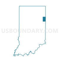
Outline

Summary
| Unique Area Identifier | 576030 |
| Name | BLUE CREEK |
| County | Adams County |
| State | Indiana |
| Area (square miles) | 24.30 |
| Land Area (square miles) | 24.30 |
| Water Area (square miles) | 0.00 |
| % of Land Area | 100.00 |
| % of Water Area | 0.00 |
| Latitude of the Internal Point | 40.71255710 |
| Longtitude of the Internal Point | -84.83554630 |
Maps


Graphs
Select a template below for downloading or customizing gragh for BLUE CREEK, Adams County, Indiana


Neighbors
Neighoring Voting District (by Name) Neighboring Voting District on the Map
- BLACKCREEK TOWNSHIP Voting District, Mercer County, OH
- JEFFERSON, Adams County, IN
- PRECINCT WILLSHIRE, Van Wert County, OH
- SOUTH MONROE, Adams County, IN
- SOUTH WASHINGTON, Adams County, IN
- ST. MARYS, Adams County, IN
- WABASH, Adams County, IN
Top 10 Neighboring County Subdivision (by Population) Neighboring County Subdivision on the Map
- Washington township, Adams County, IN (10,151)
- Wabash township, Adams County, IN (6,223)
- Monroe township, Adams County, IN (4,858)
- Willshire township, Van Wert County, OH (1,584)
- Blue Creek township, Adams County, IN (1,440)
- St. Marys township, Adams County, IN (1,308)
- Jefferson township, Adams County, IN (1,089)
- Black Creek township, Mercer County, OH (612)
Top 10 Neighboring Unified School District (by Population) Neighboring Unified School District on the Map
- South Adams Schools, IN (10,536)
- Adams Central Community Schools, IN (8,779)
- Parkway Local School District, OH (6,007)
Top 10 Neighboring State Legislative District Lower Chamber (by Population) Neighboring State Legislative District Lower Chamber on the Map
- State House District 77, OH (118,691)
- State House District 75, OH (112,019)
- State House District 79, IN (62,178)
Top 10 Neighboring State Legislative District Upper Chamber (by Population) Neighboring State Legislative District Upper Chamber on the Map
- State Senate District 1, OH (351,303)
- State Senate District 12, OH (346,477)
- State Senate District 19, IN (118,949)
Top 10 Neighboring 111th Congressional District (by Population) Neighboring 111th Congressional District on the Map
Top 10 Neighboring Census Tract (by Population) Neighboring Census Tract on the Map
- Census Tract 307, Adams County, IN (6,291)
- Census Tract 305, Adams County, IN (6,070)
- Census Tract 9672, Mercer County, OH (3,769)
- Census Tract 304, Adams County, IN (3,400)
- Census Tract 203, Van Wert County, OH (2,623)